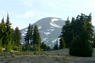
We drove out to central Oregon with our pals Eric and Kelly. The drive should have been about 4 hours, but about halfway in we got stopped in traffic by a forest fire that had actually reached the road. We were about two miles back from the fire, and were told that it would be about an hour until traffic was let through! We happened to be just about in the middle of nowhere, so it would have taken even longer to backtrack and take another route. So, we waited. Definitely a new experience to be held up by a forest fire. Once we got going, we could definitely see where the forest and road were completely charred.
We finally made it to the base camp on Friday evening. The whole group (13 in total) was able to stay in the same house together, about 45 minutes from the trailhead. We had a spaghetti dinner that night and hit the hay early. In order to get going at a reasonable time, we had to get up at 4:00am. I can't remember the last time I saw 4am. We left the house at 5:00am, to reach the trailhead by 5:45am.
Here is our GPS route, taken from our handheld:

The full map with data can be found here. I also thought it was pretty sweet to look at in satellite view:

There were sort of three phases to the climb. The first couple miles were ascending through the woods, thick with mosquitos. After that, we spent a couple miles hiking across the part known as "the golf course," a really flat and open trail with not much elevation gain. The last couple of miles were brutal, climbing in earnest up to the summit.

The next two photos were meant to stitch together to form a panoramic shot, but I did something wrong and they don't quite match up. This is Broken Top mountain and Morain Lake.

 Yet another picture of some Red Paintbrush. This trail had the most vibrant rosey-red paintbrush I've seen yet.
Once past the golf course, we started climbing in earnest. The terrain became much more rocky and sandy at this point.
For the last mile and a half or so, the terrain turned to soft red volcanic soil... almost like traversing the surface of Mars. This terrain was extremely soft, so with each step we would slide back about a half step. This phase was also extremely steep, so from this point on it was very.... slow... going.


This is the point where the altitude really started to get to me. It was very difficult to take deep breaths, so I had to stop about every 5th step to catch my breath. I felt extremely heavy, and like I was barely moving with each step. Several times I looked up at the summit and wondered how in the hell my I was going to push myself there. It took a very long time, and every ounce of physical and mental strength in my body, but I made it.
Once at the top, we then had to traverse the Rim Trail which takes us around the rim of the summit up to the true summit.
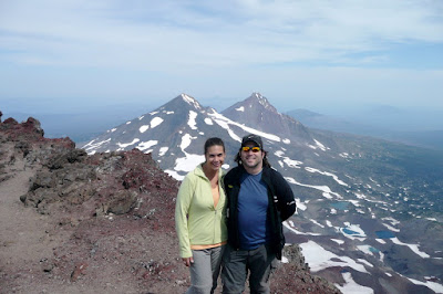
We made it! The views from the summit were surreal. At 10,358 feet, you can even see the curvature of the earth. Pretty wild.
The descent was also fairly brutal, but we made it in no time. The ultra soft terrain actually proved to make the descent a little easier, at least on the joints. You could just dig your heels in hard, and slide down a foot or two with each step. Not gonna lie though, the steeper areas were tough. It was hard to take one confident step.
 The further along we got, the more I remembered we were in high desert. The sun was beating down now, at about 90 degrees.
As you can imagine would be the case with Spartans, as soon as everyone made it down we got to celebrating!
The group organizer also had Nike MSU t-shirts made up for us to commemorate the day.

After a well-deserved night of eating and drinking, we all crashed pretty hard. We packed up and headed out Sunday morning.
I can honestly say this was the most physically and mentally demanding thing I've done, probably in my life. Even though we've been doing progressively more difficult hikes all summer to prepare, this was harder than I thought it would be. BUT, we all made it, and it was so worth it! I think we'll back off on the really tough hikes for a while, but there are plenty of slightly easier and still beautiful hikes out there. My Dad is coming out camping/hiking next weekend, so we'll be hitting the trail again in no time!
Love,
Jenny
p.s. HAPPY BIRTHDAY DAD!! xoxo :)


2 comments:
OMG, WOW, OMG, WOW!... I'm sure you will remember thoe views forever!
I havent had a computer to use in quite awhile other than my phone- but i finally got to look at the blog again and the pictures from this hike are amazing!
Post a Comment