On the drive there, it is very clear when you have entered high desert. All of a sudden the landscape changes from soaring evergreens to small shrubs and trees growing out of sand. The drive was about 3 three hours long, but there was plenty to see along the way, which made it seem like a much quicker trip.
We made a stop on our way into Bend at Smith Rock, a state park that is considered by many to be the birthplace of rock climbing. For good reason... this place is full of craggy cliffs and soaring rocky spires. There are also miles of trails. We opted to take the "most difficult" route up to see Monkey Face, a spire that resembles... you guessed it... a monkey face. The trail was only .75 miles long, easy right? Oh, except for the constant steep uphill grade the entire way, in the beating desert sun. Add in the fact that I was breaking in brand new hiking boots. It was seriously the longest .75 miles of my life.


After all that climbing, we figured we earned a good lunch. We stopped at Pilot Butte Drive In, for some deliciously fat burgers, fries, and chocolate shakes. Mmmm.

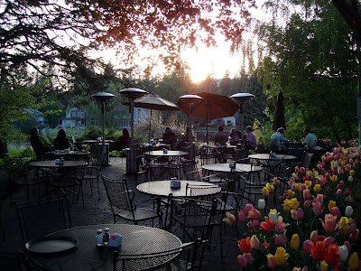
I didn't really get any photos, but for the evening we just wandered around downtown Bend and checked out the scenery. We had dinner at Pine Tavern, a restaurant that has been in Bend since 1936. It is situated right on the Deschutes River, complete with a 250-year old Ponderosa tree growing straight through the middle of their dining room. We opted for a table on their gorgeous patio, right on the river.


After copious amounts of food and drink, we called it a night after dinner. The next day we had a couple more hikes planned, so we got an early start on it. The drive was again complete with breathtaking views of the Cascades.
 From left to right: Mt. Bachelor, South Sister, Broken Top Mountain. Did I mention we'll be at the top of that monster in two months?!
Our first stop was Newberry National Volcanic Monument, 50,000 acres of lava flows, lakes, and volcanoes. We headed to the Big Obsidian Lava Flow to traverse the area's youngest lava flow. And yep, that's snow everywhere... it's crazy how quickly the landscape can change around here. Dogs aren't allowed on this trail since the sharp obsidian can cut their feet, so we let him romp around at the base for a while.
 Where the lava flow crawled to a rest. The shiny obsidian, a volcanic glass, made this entire place sparkle in the sun.
After a quick lunch/beer break at Three Creeks Brewery in Sisters, OR, we headed to Black Butte for another hike. And took a few more pictures on the way, of course.
 A clear view of the Three Sisters, North, Middle and South (South Sister is all the way to the left).
Black Butte is a cinder cone volcano located in Deschutes National Forest, with an elevation of 6,436 feet. The trail we hiked is about 4 miles round trip, with an elevation gain on the way up of about 1,500 feet. Once we were above the treeline, the views on this hike were absolutely stunning. It is quite the experience to hike while completely surrounded by mountain views.


After Black Butte, it was time to head home. We had such an awesome time on our mini-vacation, I can't wait to go back and explore more of this area. I am even more motivated to get in shape for South Sister after these gorgeous expeditions.


No comments:
Post a Comment